Route & what to see
![]()
|
A Penge Walk Route & what to see |
|
london-footprints.co.uk |
Penge is described in the Domesday Book as a wood for 50 hogs. It remained a rural area with a population of only 270 in 1841 (of whom a number were almspeople) even though it had had a railway since 1839. The population rose to 1169 in 1851 but the biggest impact on Penge was the re-siting of the Crystal Palace. This building housing the Great Exhibition had been a great success during 1851 in Hyde Park and when it closed its designer Joseph Paxton formed a company to purchase it for £70,000 plus land at Penge Place for £50,000 where it was re-erected in 1852-4. The London & Brighton Railway built a line and a station to serve the Palace so that by 1861 the area had developed and the population risen to 5015.
Although Penge has no pre-Victorian buildings it can boast 3 groups of almshouses together with conservation areas and other buildings of interest including canal /railway features.
Circular walk of 2¼ miles from Penge West Station. Penge East Station is also on the route. You can extend the walk by exploring Crystal Palace Park [more info]
Begin at the station forecourt
The Croydon Canal was built by John Rennie between 1801-9 and
went from West Croydon to Peckham then via the Grand Surrey into
the Thames and was used for the carriage of bulk goods. However
it had a short life and in 1836 was sold to the London &
Croydon Railway who drained the canal and used much of the route
for its line, opened in 1839. The white building was the original
station building and gatekeeper's house as the line crossed the
road at a level crossing. However this station was so little used
that it closed in 1841. It re-opened in 1863 (on the same date as
the London Chatham & Dover's line through Penge East) with a
new station building - still in use. Station buildings on the
other side of the line (extended in 1889) were demolished in the
1970s.
Walk to the right down Anerley
Park into the main road.
The railway on the left is the branch line to Crystal Palace 'Low
Level' Station of 1854. The line on the right is the former
London & Croydon with a bricked up station entrance. In 1845
an extra (atmospheric) line was added and the crossing replaced
by a bridge when the road had to be lowered. Between the two
lines to the north of the road a wharf was sited in the days of
the canal.
Go right along the High Street
Homebase occupies the site of a coal yard.
Cross and go left up Kingswood
Road
Look for boundary markers outside numbers 52 & 55. Penge has
been 'moved' from Surrey to Kent to London and back to Kent
again! At the end of the road is the former Park Farm Dairy
Building. Prior to development cows would have grazed on nearby
Penge Common.
Go right along Station Road
Numbers 9 & 11 are locally listed for their attractive
brickwork. The Good Shepherd RC Church was built as the Holy
Trinity Mission Hall in 1885 especaily for the poor.
Continue to Penge
East Station
Towards London the line goes through a 1¼ mile
long tunnel under Sydenham Hill. Jutting onto the platform is
another crossing keeper's cottage. Adjacent to this are the
premises of Tomei & Sons. This old-established family firm
makes plaster decorations including pieces for some notable
London buildings
Go right at St John's Road
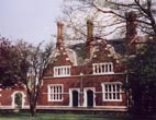
On the right are some attractive almshouses of 1848. These were
built at the request of Queen Adelaide, in memory of her husband
William IV, as a Royal Naval Asylum for 12 widows or orphan
daughters of officers. Designed by Philip Hardwick in a Tudor
style they are now private residences.There is a boundary post
near the entrance. The flats opposite were designed for Penge
Urban District Council by Edward Armstrong and have a plaque
denoting their Festival of Britain Award for Merit. They replaced
Victorian housing damaged by bombing. At the end of the road is
the Grade II listed church of St John the Evangalist designed in
1850 by Edwin Nash. Until 1855 Penge was a hamlet of Battersea,
seven miles away. The land and £1000 towards the £4000 cost was
given by John Dudin Brown, the benefactor of the Watermen &
Lightermen who appointed the clergy. It was enlarged in the 1860s
and a steeple was added to the original tower.
Turn left into the High Street
The Watermen & Lightermen's Almshouses were
built 1839-1843 for retired Company Freemen and their widows. An
obelisk records the gift of finance and 2 acres of land from
Dudin Brown of Sydenham. Designed by George Porter they
originally provided 48 3-roomed homes. The almspeople moved to
Hastings in 1973 and the buildings were converted to larger
private homes. The corner lodge records the restoration of the
almshouses as a war memorial to company freeman and apprentices
killed in WWI.
Cross Penge Lane
The Penge Triangle now features pterodactyl wing structures and a
piece of Millennium Rock. It has been the site of an ancient oak
with seats, a shell grotto, a horse trough and underground
toilets. The Crooked Billet pub was re-built in 1840 and served
as a venue for local meetings. Originally a wooden building of
1792 it was demolished for the construction of the almshouses.
The frontage was altered around 1960 following war damage.
Go along Penge Lane
On the right is a small square of cottages from before 1843. At
the end is The Alexandra (Tavern) built around 1869 with
stabling.
At the end cross Parish Lane
into Albert Road.
The 164 cottages in these 'regally' named roads were built in
1866-8 by the 'Metropolitan Association for Improving the
Dwellings of the Industrious Classes' established in 1841. Most
are now privately owned and many were 'improved' before it became
a conservation area. There are former Estate Office and School
buildings on Parish Lane. The schoolroom also housed a library
and provided facilities for adult education and entertainments.
It closed in 1880 and was converted into housing.
Go to the end of Albert Road,
left and then right along Hardings Lane
Hardings Lane is named after the turnpike proprietor as it was
the route between Penge and Sydenham. A plaque gives some
information on the 'Alexandra Cottages'. Across the road is the
Alexandra Recreation Ground laid out on part of the former Penge
Cricket Ground.
Go right along Lennard Road
On the left is Holy Trinity church built in 1878 on land given by
Albemarle Cator. Designed by Daukes & Clarke it was financed
by Francis Peek (of Peek Freans biscuits) as a memorial to his
parents. It has been imaginatively restored following an arson
attack in 1993. Contact phone no 020 8778 7258. [webpage]
Opposite Cator Road go through
to Victor Road. At the end go left along Parish Lane to the
crossroads and turn right into Green Lane.
The church building on the corner was formerly the Penge &
Beckenham Co-op (1901). A horse trough remains in this road.
Continue to the traffic lights
The range of shops called Central Exchange was built in 1899. The
police station was opened in 1872 to replace a temporary building
of 1870. Diagonally opposite on a site now occupied by Tudor Park
Estate Agents was the Penge Chapel of 1837. It became a school
when St John's Church was built in 1850 and was demolished in
1937. The Pawleyne Arms provided horses for the local fire
engine.
Go right along the High Street
On the left are two squares. The one by the entrance to the
Blenheim Shopping Centre features sails & a Blitz plaque and
the other by the public toilets has a dinosaur theme. The first
square is on the site of the Empire Theatre, designed by WGR
Sprague and opened in 1915, in which famous Music Hall names
appeared. It became the Essoldo Cinema in 1949 and was demolished
in 1960 when its fittings were sold off.
Go left along Maple Road
This road leading to Anerley once had a popular street market. On
the right are St John's Cottages built in 1863 as almshouses by
Edwin Nash the church architect. Number 8 was rebuilt after a gas
explosion in 1959. Opposite is the library and Salvation Army
Citadel (1894)
Turn right into Blean Grove
and opposite Gladstone Mews go into the recreation ground to the
right.
This was opened in 1888
Continue either side of the
playground through to the High Street
The War Memorial for those killed in WWI was unveiled in 1925.
The names of those who died in WWII were added later.
Go left along the High Street
Two large houses of c1840 remain. Number 54 was the home of the
Penge & Beckenham Liberal & Radical Club but is now
flats. Number 52 (The White House) is a dental surgery. Opposite
on the corner of Mosslea Road is a former Methodist Chapel that
once served as a Soup Kitchen for the poor. It has been converted
for residental use.
Continue along the High
Street. Anerley Park on the left leads back to the station or a
little further on is the entrance to Crystal Palace Park.
The park has a cafe and information centre
Resources
Bromley Local Studies & Archives have produced an
illustrated booklet 'A Walk Around Penge' (small charge). It may
be available in Bromley Central Library which will have other
information about the area.
There is a book of old photographs selected and captioned by Mick
Scott
Doris Pullen has written a book about Penge which was revised in
1990
'Around Crystal Palace & Penge' by David R Johnson
© london-footprints.co.uk 2012