Route & what to see
![]()
|
A Peckham (South) Walk Route & what to see |
|
london-footprints.co.uk |
This 3¼ mile circular walk from Peckham Rye Station includes regeneration projects and other features of interest. It can be extended by visiting Peckham Rye Park and can also be combined with the Peckham (north) route as indicated in the text.
Exit station and go left
along Rye Lane.
The station opened in 1865 and in 1921 the waiting room became a
billiard room. The last Sainsbury's shop with counter service was
at 61-3 Rye Lane (now Clarks shoes) and closed in 1982. The
neighbouring Baptist Chapel opened in 1863.
Left into Highshore Road
The Royal Mail Delivery Office includes the former Quaker Meeting
House of 1826.
Left along Bellenden
Road.
Beyond the railway the Peckham Experiment has mosaics by Tom
Phillips.
Detour into Choumert Road to
the left
The Petitou Cafe has a map terrace by Lorraine Rutt.
Return to and continue along
Bellenden Road
The award winning renewal area includes artwork by Anthony
Gormley, Tom Phillips, Heather Burrell and others. Flat Time HO
has a book relief by John Latham and Topiary outside the school
was created by Lucy Swan.
At the end go left along
Oxenford Street and left at Oglander Road
These streets are part of the Grove Vale estate.
Right at Marsden Road.
The houses have attractive railings and gates. On the right is
the Centre for Wildlife Gardening run by the London Wildlife
Trust. It was established in 1989 to provide new trees following
the hurricane of October 1987 but now offers ideas for attracting
wildlife to gardens.
Continue to the end of the
road. Go right at Ondine Road and left at Grove Vale to the
roundabout. Walk alongside Goose Green to the left.
This was the village green of East Dulwich (look for goose-themed
artwork). Across the green are public baths (undergoing
redevelopment). St John the Evangalist Church was designed by
Charles Bailey in 1863-5 but rebuilt post war. Behind the
children's playground at the far end is a mural 'William Blake's
Vision of Angels'.
Continue along East Dulwich
Road
The parade of shops/cafes has street furniture designed by Zandra
Rhodes.
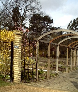
At the traffic lights
continue ahead along Nunhead Lane (unless exploring
Peckham Rye Park which lies beyond the common to the right)
On the corner was an air raid shelter for 672 and in WWII hay
crops were grown. The area to the left had a lido opened in 1923
and closed in 1987. The common was used for sports & fairs
and had a bandstand (destroyed in WWII). In both wars huts held
POW's (one remains as a playgroup centre).
Continue along Nunhead Lane
Further along on the right was the site of a Bus Garage operated
by the National Steam Car Company 1911-9. The clock tower has
been recreated in the development (plaque). On the left in
Consort Road is the former Relief Station of 1901 (now a health
centre).
Continue to Nunhead Green
The Metropolitan Beer & Wine Trade Society built seven
almshouses for 13 residents in 1852. A new wing of eight houses
was added in 1872. These front Gordon Road where there is also
the Passmore Edwards Nunhead Library of 1896.
Return to the Nun's Head pub
(rebuilt 1934)
A notice explains the story behind the name.
Go along Scylla Road by the
pub into Consort Road
Across the road are Beeston's Almshouses, built for the Girdlers
Company in 1834. They replaced buildings which were sold for the
construction of London Bridge in 1824. The seven houses (extended
in the 1960s) were for freemen of the company who also received a
pension.
Continue past these along
Consort Road then left at Godman Road
The former church school of St Mary Magdalen (1856) has been
converted to accommodation.
Go left at Claude Road then
right at Heaton Road
The former site of the RACS on the left has been redeveloped.
Cross Peckham Rye into
Sternhall Lane. Follow this round into McDermott Road.
Just past Choumert Grove on the right is McDermott Grove Wildlife
Garden, renovated by the BBC and local residents.
Return to and go left at
Choumert Grove.
On the corner a pre-fab remains (due for demolition). Further
along is the Peckham Islamic Centre (mosque). On the right just
past Choumert Road is Choumert Square built 1876-82. This gated
garden is noted for its floral displays.
Return and go left along
Choumert Road.
Palyn's Almshouses were built by the Girdlers Company in 1852.
Their original premises had been founded in 1612-3 in Old Street
but were destroyed in the Great Fire.
At the end go left along Rye
Lane to the station
There are remains of the Tower Cinema opened in 1914. The
basement was used as a shelter dring WW1. It closed in 1956 and
now provides an entrance to the car park.
To include the north section
continue along Rye Lane to Peckham Square
Only the corner building remains of the former Jones &
Higgins store. This began in 1867 and took over more premises
until replaced in 1985 by the Aylesham Centre.
Resources
The Story of Peckham and Nunhead by John D Beasley (LB Southwark
Neighbourhood History No 3)
Discover the Real Peckham (Information leaflet produced by Southwark Council and the Peckham Society)
Buildings of England - London 2: South by Cherry & Pevsner
Restoration of Peckham Rye Park [article]
Friends of Peckham Rye Park [website]
London Wildlife Trust [website]
© london-footprints.co.uk 2010
[walks list] [places to visit] [almshouses]